


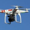
The Unmanned Aerial Vehicle (UAV) Air Quality Monitoring Drone.
The measuring of air quality identifies pollutant levels by measuring the quantity of certain pollutants in the external outdoor air.
Monitoring of –
-
- The ozone – ultraviolet spectroscopy;
- Sulfur Dioxide – florescent spectroscopy;
- Nitrogen oxides – chemiluminescence;
- Ammonia – chemiluminescence;
- Carbon Monoxide – infra spectroscopy;
- Visibility – nephelometer;
- Fine particles PM10 and PM2.5;
Australia has its own Australia Air Quality Index (AQI) system. The AQI of simple design allowing an easier may for pollution levels to be monitored and shared with the general public so they understand and can view the health risks.
UAV air quality monitoring system can simultaneously monitor the air temperature, humidity, illumination, PM10, PM2.5, SO2, NO2, CO, O3 (extended wind direction, wind speed) and other characteristic pollution parameters by configuring a variety of high-precision intelligent gas sensors.
It can cooperate with the ground-end monitoring system to check the number of gases in the environment where the UAV is located in real time. The unmanned aerial vehicle remote sensing system has the characteristics of wide field of vision, timely and continuous, and can quickly identify the current situation of the environment.
Miniaturised monitoring equipment with the latest technology are used for environmental monitoring objects such as urban residential areas, rural villages and towns, industrial parks, key industrial enterprises, road traffic, construction sites, regional boundaries, pollutant transmission channels and so on.
They are distributed in large-scale and high-density “combined sites”.
A “group” collaborative monitoring network and professional data calibration system are formed to achieve full coverage of the precise environmental monitoring network.
The grid distribution of pollution source enterprises, construction sites, traffic arteries, sensitive areas, transmission boundary areas and the whole urban and rural areas, combined with three-dimensional monitoring and mobile monitoring, forms a complete online monitoring network.
ARMS: 3D Air Quality Index (AQI) Monitoring System using UAV Sensing Video
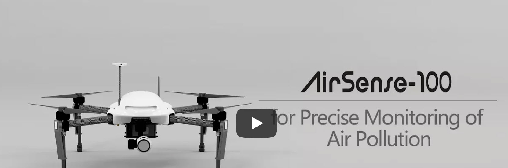
APIS Inc. Air Quality Monitoring with UAVs – Critical Design Review Video
Item Parameters ZAQ250 ZAQ260 ZAQ270 ZAQ280 ZAQ380 ZAQ550 ZAQ650 ZAQ560 ZAQ660 Particle Principle: Laser Scattering
Measure Type: PM1.0/PM2.5/PM10
Measure Range: 0-1000ug/m3
Measure Resolution: 0.3ug/m3
Measure Accuracy: ±15% or
±10μg/m3■■■■■■■■■Noise Measure Range: 30-130dB(A)
Measure Accuracy: 1.5dB■■■■■Temperature Measure Range: -40-85°C
Measure Resolution: 0.1°C
Measure Accuracy: 0.3°C■■■■■■■■■Humidity Measure Range: 0-100%
Measure Resolution: 0.1%
Measure Accuracy: 2%■■■■■■■■■Pressure Measure Range: 10-1200hPa
Measure Resolution: 0.1hPa
Measure Accuracy: 0.3hPa (At 25°C)■■■■■■■■■Wind Direction Measure Range: 0-360°
Measure Resolution: 0.1°
Measure Accuracy: 3°■■■■■■■■■Wind Speed Measure Range: 0-60m/s
Measure Resolution: 0.1m/s
Measure Accuracy: ±0.3m/s or ±3%■■■■■■■■■Raindfall Measure Range: 0-200mm/Hour
Measure Resolution: 0.2mm
Measure Accuracy: 3%*■■■■■■Radiation Measure Range: 0-2000w/m2
Measure Resolution: 1w/m2
Measure Accuracy: 5%*■■■UVI Principle: Silicon Light
Measure Range: 0-15 UVI■■Photogragh 1920*1080 ■■■CO Measure Range: 0-1000ppm
Measure Resolution: 0.1ppm■■■■SO2 Measure Range: 0-20ppm
Measure Resolution: 1ppb■■■■NO2 Measure Range: 0-20ppm
Measure Resolution: 1ppb■■■■O3 Measure Range: 0-20ppm
Measure Resolution: 1ppb■■■■Compass Principle: Electronic
Measure Range: 0-360°
Measure Resolution: 0.1°
Measure Accuracy: 1°*ZAQ25C ZAQ26C ZAQ27C ZAQ28C ZAQ38C ZAQ55C ZAQ65C ZAQ56C ZAQ66C GPS Build-in Module ZAQ25G ZAQ26G ZAQ27G ZAQ28G ZAQ38G ZAQ55G ZAQ65G ZAQ56G ZAQ66G Wireless LTE/Wifi/Bluetooth/Lora LTE -G
Wifi -W
Lora -L